Navigating Belfast City Centre: A Map Guide
A map of Belfast city centre reveals a relatively compact and easily navigable urban space, characterized by a grid-like street pattern in its core. This makes exploring the city’s historical landmarks, vibrant shopping districts, and cultural hotspots relatively straightforward. At the heart of the map lies Donegall Square, dominated by the iconic Belfast City Hall. This impressive building serves as a central point of reference, with major thoroughfares radiating outwards.
Heading north from Donegall Square takes you to Royal Avenue, the city’s primary retail street. Here, you’ll find department stores, flagship retail outlets, and access to CastleCourt Shopping Centre, a multi-level complex housing numerous brands. The area around Royal Avenue is a bustling hive of activity, especially during peak shopping hours.
East of Donegall Square lies the Cathedral Quarter, a historic district renowned for its cobbled streets, Victorian architecture, and vibrant arts scene. The map highlights St. Anne’s Cathedral, a striking landmark that gives the area its name. This quarter is teeming with pubs, restaurants, art galleries, and performance venues, making it a hub for entertainment and cultural experiences. Be sure to look for entries to ‘Entries’ which are small alleyways connecting the main streets with some of the oldest pubs in Belfast.
To the south of Donegall Square, the Golden Mile, stretching along Great Victoria Street, offers a diverse range of attractions. The Grand Opera House, a magnificent Victorian theatre, stands as a testament to Belfast’s rich cultural heritage. This area also boasts numerous hotels, restaurants, and bars, catering to both tourists and locals alike. The Europa Hotel, infamously known as the most bombed hotel in Europe, is also a notable landmark on this street.
West of Donegall Square, you’ll find the Linen Quarter, historically the heart of Belfast’s linen industry. While the linen mills are mostly gone, the area retains its industrial charm, with many old warehouses now converted into offices and apartments. The Ulster Hall, a renowned concert venue, is a key landmark in this area. This section of the map is undergoing significant regeneration, with new developments blending seamlessly with the historical architecture.
The River Lagan forms the eastern boundary of the city centre, and the map showcases the Waterfront Hall, a prominent conference and entertainment venue located on its banks. The area around the river has been significantly redeveloped in recent years, creating a pleasant waterfront environment with walking paths and public spaces. The iconic ‘Big Fish’ sculpture is a popular photo opportunity in this area.
Overall, the Belfast city centre map showcases a compact and well-planned urban environment. Its grid-like layout, coupled with prominent landmarks, makes navigation relatively simple. The diverse range of attractions, from historical buildings and shopping districts to cultural venues and waterfront spaces, ensures that there’s something for everyone to discover in this vibrant city.
 1641×2286 belfast city center map from ontheworldmap.com
  722×1024 belfast city centre map printable printable maps from freeprintableaz.com
  1800×1179 large belfast maps print high resolution detailed maps from www.orangesmile.com
  858×729 map belfast city centre gadgets from gadgets2018blog.blogspot.com
  1024×669 belfast city center map topdjs regard belfast city centre map printable printable maps from printable-map.com
  621×719 belfast city map printable from map.jace.org.uk
  700×1100 tourist attractions belfast planetware from www.planetware.com
  1024×670 belfast city center map topdjs belfast city centre map printable printable maps from printable-map.com
  1277×798 map belfast city centre street map global map from leefbaarheidbrabant.nl
  1000×514 belfast northern ireland uk vector map city plan detailed small print size street from vectormap.net
  2481×3508 bye laws good governance belfast city centre from www.belfastcity.gov.uk
 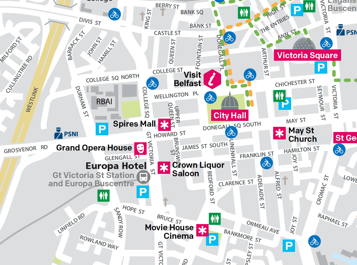 1388×1030 belfast pied pied du centre ville de belfast en francais from www.belfast-a-pied.com
  856×941 belfast map from www.worldmap1.com
  1000×508 map belfast printable vector exact detailed city plan buildings from vectormap.net
  1080×1528 belfast centre map etsy from www.etsy.com
  2456×3473 belfast mapa chorvatsko mapa from corneliusnealie.blogspot.com
  638×800 belfast cruise port guide cruiseportwikicom from cruiseportwiki.com
  844×608 belfast street map gadgets from gadgets2018blog.blogspot.com
  1024×852 map belfast historical belfast map fine print paper canvas artofit from www.artofit.org
  950×650 belfast map ireland from www.worldmap1.com
  640×494 map belfast city centre rnorthernireland from www.reddit.com
  1000×509 belfast city map printable printable maps vrogueco from www.vrogue.co
  768×673 belfast city centre trail hopsskipsandjumps from hopsskipsandjumps.com
  983×1500 belfast pocket map perfect explore belfast amazoncouk collins maps from www.amazon.co.uk
  1200×899 vintage ordnance survey map belfast city centre square emporium from onthesquareemporium.com
  4057×3177 belfast street map from ar.inspiredpencil.com
  1000×559 city centre parking access belfast city centre management from www.belfastcentre.com