Rostov-na-Donu, a vibrant city in southern Russia, is best explored with a good map. Understanding its layout allows you to navigate its historical districts, bustling markets, and scenic riverfront with ease. Maps of Rostov-na-Donu come in various formats, from traditional paper versions to interactive digital ones available on smartphones and online platforms. These resources typically highlight key points of interest, transportation networks, and administrative divisions.
At the heart of Rostov-na-Donu lies its central district, often marked prominently on maps. This area encompasses landmarks like the Rostov State Musical Theater, the Maxim Gorky Academic Drama Theater, and the Central Market (also known as the Old Bazaar). A map will clearly show Bolshaya Sadovaya Street, the city’s main thoroughfare, stretching east-west through the central district. Along this street, you’ll find a concentration of shops, restaurants, and historical buildings, all easily identifiable on a detailed map.
The Don River plays a crucial role in Rostov-na-Donu’s geography. A map will illustrate the river’s winding course and the various bridges that span it, connecting different parts of the city. The Voroshilovsky Bridge and the Rostov Bridge are particularly significant, facilitating traffic flow and offering panoramic views. The embankment along the Don, known as the Rostov Embankment, is another key feature, marked with walkways, parks, and riverside restaurants. Maps often denote boat tours and recreational activities available along the river.
Beyond the central district, maps reveal the broader urban landscape, including residential areas, industrial zones, and parks. The Leninsky District, located to the south of the central area, is another significant area, frequently featured with its own unique set of landmarks and amenities. Areas further from the center, such as the Zapadny residential district, are shown connected by major roads and public transportation routes.
Transportation networks are vital aspects of any Rostov-na-Donu map. The city boasts a network of buses, trams, trolleybuses, and marshrutkas (minibuses). Maps often incorporate these routes, allowing users to plan their journeys effectively. The Rostov-on-Don Airport (Platov International Airport), located northeast of the city, is another essential feature, marked with its connecting routes and transportation options. Railway stations, like the Rostov-Glavny railway station, are also clearly indicated, facilitating travel to and from other cities in Russia.
Modern digital maps offer enhanced functionality, including real-time traffic updates, user reviews, and integrated navigation systems. These online tools enable users to search for specific addresses, businesses, and points of interest. Furthermore, satellite imagery and street view options provide a realistic representation of the city’s landscape. Whether you prefer a traditional paper map or a cutting-edge digital version, a map of Rostov-na-Donu is an invaluable tool for exploring this dynamic and historically rich city.
 560×392 large rostov na donu maps print high resolution detailed maps from www.orangesmile.com
  750×750 map rostov na donu russia global atlas from www.europa.uk.com
  474×301 rostov na donu from www.sfu.ca
  354×301 rostov don map from www.turkey-visit.com
  950×650 rostov don map russia from www.turkey-visit.com
  1300×957 rostov na donu pinned map russia stock photo alamy from www.alamy.com
  619×446 map rostov na donu buy vintage map replica poster print picture from www.discusmedia.com
  1300×956 rostov na donu fotografias imagenes de alta resolucion alamy from www.alamy.es
  1080×720 rostov na donu map print printable rostov na donu map art russia map rostov na donu print from www.etsy.com
  1409×2000 rostov na donu map print printable rostov na donu map art etsy from www.etsy.com
  1024×604 maps city maps atlases rostov na donu rostovskaia ovlast from www.karsuveikals.lv
  2550×1421 rostov don map rostov don satellite images from www.istanbul-city-guide.com
  1300×956 rostov na donu russia map gillie donnamarie from dulcineobari.pages.dev
  728×425 rostov na donu russia rostov na donu rostov oblast map worldatlascom from www.worldatlas.com
  949×502 rostov na donu located country rostov na donu rostov na donu map from whereismap.net
  1300×957 rostov na donu map europe stock photo alamy from www.alamy.com
  2382×2580 rostov na donu vikipedi from tr.wikipedia.org
 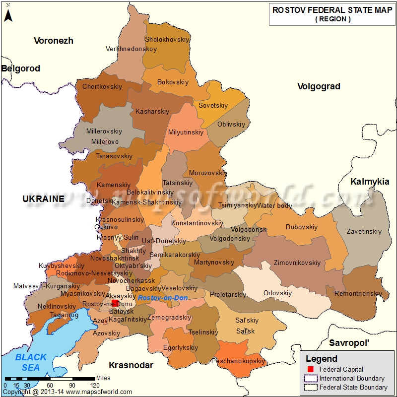 800×800 rostov map oblast rostov russia from www.mapsofworld.com
  425×398 division rostov na donu russian defense policy from russiandefpolicy.com
  1048×538 ou se trouve rostov sur le don ou se situe rostov sur le don ou se trouve from ousetrouve.net
  850×500 political location map rostov na donu from www.maphill.com
  1092×499 dove trova rostov na donu mappa rostov na donu dove trova from dovesitrova.net
  600×371 guia urbano de rostov del don from es.weather-forecast.com
  728×425 rostov don airport rov worldatlas from www.worldatlas.com
  850×523 political map rostov na donu from www.maphill.com
  780×455 rostov oblast from www.russianlessons.net